Our Sunday winter storm continues into the afternoon and evening. We received several inches of snow overnight, with 0.1 to 0.25 inches of ice in parts of Connecticut, Rhode Island, and western Massachusetts.
This afternoon and evening, an additional tenth to quarter inch of ice is expected in the same areas outside of Interstate 495. Meanwhile, more rain is falling in Boston and along Interstate 495. Approximately 1 inch of rainfall is expected through Sunday night. It’s time to clear the snow and ice before the heavy rain. Some local urban flooding will be an issue.
Snow continues in the mountains and ski areas until Sunday night, with the North Country receiving 9-12 inches by 11 p.m. Watch for sleet to mix in across southern Vermont and New Hampshire slopes as we pick up another 3-5 inches of snow.
The wind increases significantly this evening as a surface low strengthens and moves into the Gulf of Maine Sunday night. As it moves away from New England on Monday, we expect westerly winds of 20-30 mph with gusts up to 50-60 mph.
Damage and outages will be more widespread in higher elevations and along the coast, with the weight of snow and ice being a concern in high terrain.
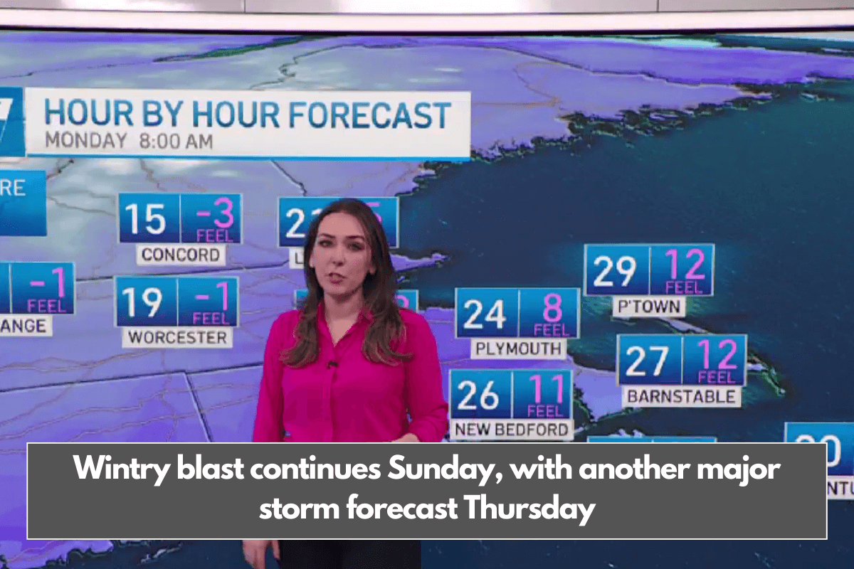
The blustery conditions will cause temperatures to drop to the 20s on Sunday night, and it will become extremely icy. Wind chills will be near zero Monday morning as we move into drier air by midweek.
Our next storm is expected around Thursday, and it will be a coastal storm. The forecast models agree that a large storm will develop, but they disagree on the track.
If the storm tracks further north, southern New England will receive several inches of snow and some wind. However, a miss is also possible with this storm.